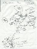
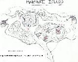
| Maps and Blueprints | |
Current Maps | WWII Era Maps | Blueprints not yet available.
| Top of Page | ||||
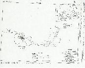 |
NEVSKI IS. This Army map shows the first island on the causeway. Today there is lots of trash and an old gate across the road probably dating from after the war. According to the map there was a ration storehouse here during the war. |
|||
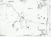 |
VIRUBLENNOI IS. & GOLD IS. This Army map shows the third and fourth islands of the causeway. Today there are three ammunition magazines remaining on Virublennoi island. There is also rock clearing where the ration storehouse was located and the rusted remains of a crane. On Gold island there is a wooden fuse house still standing and a concrete two-story bunker that is not marked on this map. |
|||
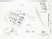 |
SASEDNI IS. This Army map shows the many building constructed on Sasedni Island. There many barracks and two large motor pools. Also, there was a theater and supply buildings. Today many foundations remain from these buildings. Unfortunately, none of them still stand. There are also four concrete 3-inch anti-aircraft positions and the meteorological station for the Sitka Harbor Defenses. |
|||
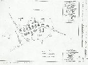 |
KIRUSHKIN IS. This Army map shows the sixth island of the causeway. There were many barracks and supply buildings on Kirushkin. Today there are two fire hydrants, many foundations, and the concrete 'temporary' Harbor Entrance Control Post (HECP), which is not shown on the Army map. |
|||
Current Maps | Top of Page| Blueprints not yet available.