The Causeway

|
The Causeway |
|
|
|
|
|
|
|
Click Image to Enlarge |
||||
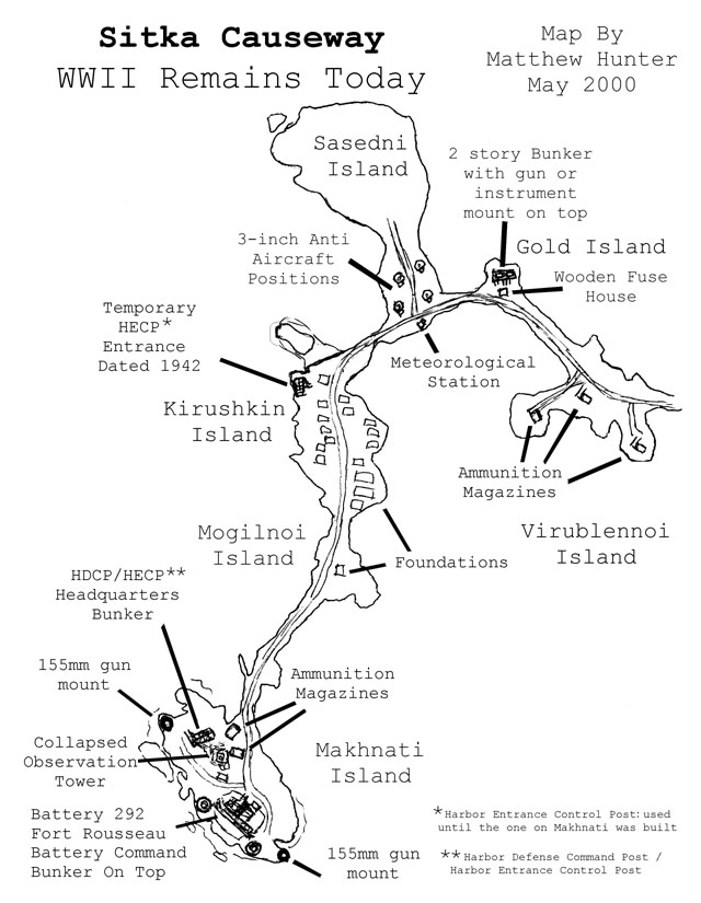 |
This map was originally hand drawn over a map I
obtained from the City of Sitka. I replaced the hand notes with typed
text and enlarged the map. Click on the map to zoom to full size.
Please feel free to make copies of this map for personal use. Click image for a larger printable version.
|
|||